

Smart Farming: How Technology Helps Promote Sustainable Agriculture
Agriculture has been evolving alongside major scientific and technological developments to respond to contemporary challenges.
In the 1960s, the invention of high-yielding cereal varieties prevented global famine, launching the Green Revolution. As the environmental toll of the overuse of agrochemicals became evident, the need for an eco-friendly shift arose. Understanding crop variability and individually attending to plant demand for water and nutrients marked the onset of precision agriculture in the 1990s. GPS-guided tractors increased the seeding accuracy and variable-rate technology (VRT) enabled the optimal use of inputs. These sustainable practices put agriculture on the right track to growing healthier crops at minimum cost and with less environmental damage.
Today, farmers face pressure like never before, having to think of the upcoming food crisis due to the population rise, climate change, lack of arable land and water, and rising energy, labor, and nutrient costs. To maintain profitability, they need to embrace smart farming technologies ,including GIS software that can help them work more precisely, efficiently, and sustainably. Among companies that offer such solutions is EOS Data Analytics.
Smart Farming as the New Norm
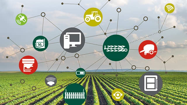
Smart farming refers to the utilization of data and information technologies for efficient crop production. Farmers who implement smart farming can enhance the quality and quantity of agricultural products while optimizing their own work.
Sensors, Internet of Things devices, autonomous robots, AI algorithms, and software solutions are tools that make the process of crop farming sensor-monitored and software-managed. Growers get quick access to crop, soil, and weather data collected by remote and in-situ sensors. Using advanced space data analytics, they derive actionable insights and combine them with their own in-field experience to make informed decisions about crop monitoring, seeding, fertilization, pest and disease management, irrigation, and harvesting. Smart agriculture methods bring economic efficiency where better crop performance is achieved with less workforce, fewer inputs, less exploited land and water, and reduced ecological footprint.
As technology advances, smart farming is expected to become mainstream, reaching the remotest rural areas where digital agricultural transformation is still challenged. Experts believe that precision agriculture, farm management software, and smart water management are among the agricultural innovations that will see the biggest growth in the coming years.
Benefits of Utilizing Agricultural Drones
Drones (also known as unmanned aerial vehicles, UAVs) represent a smart agriculture technology that already has a high level of adoption among farmers. Agriculture is, in fact, the second industry after construction where drones are in high demand. And here’s why.
The ability to make quick decisions and adapt to a fast-changing environment is what distinguishes a successful agribusiness today. Real-time updates on the state of crops, fields, and weather conditions provide the basis for informed decision-making, and drones are a great means to obtain this critical data. Equipped with specialized sensors, they collect high-resolution imagery of fields, saving time and costs that would otherwise be spent on scouting. This is especially useful in monitoring remote croplands that are hard to reach by foot.
The most widespread drone applications in agriculture include:
- Crop health monitoring
Infrared cameras are installed on drones to measure light reflected and absorbed by crops. Using a dedicated smart farming system or software, farmers can then calculate vegetation indices based on the collected data to evaluate crop health. This method enables early detection of crop issues, including heat and water stress, pest infestations, and diseases, allowing for timely response to ensure proper plant growth.
- Variable-rate application of inputs
The aerial imagery captured by drones is used to generate VRA maps. Fields are divided into zones based on crop performance that is highly dependent on nutrient availability. Based on these maps, farmers can decide on the amount of fertilizer to apply in each area, minimizing input waste and related costs. The same goes for crop protective agents: implementation of the variable-rate application of pesticides and herbicides helps to avoid chemical runoff and minimize environmental impact.
- Spraying, planting, and irrigation
Drones not only provide essential data but can also replace workers in multiple agricultural tasks, enhancing their accuracy and saving time. Using drones to spray inputs is five times faster than traditional spraying methods, and also reduces human contact with hazardous chemicals. Unmanned aircraft is also a win-win smart farming technology for irrigation: there are drones that can detect dehydrated plants with their thermal sensors, while others can be flown to the dry spot to spray the required amount of water over it. Sophisticated drones are successfully used to plant seeds, reportedly decreasing seeding costs by 85%.
Why Drones Aren’t Always the Best Way to Go
As we can see, drones benefit farmers in lots of ways, however, there are certain barriers to their adoption and things to consider before implementing this smart farming technology.
Cost: The initial costs of purchasing and maintaining a professional agricultural drone, as well as UAV pilot training, may be way out of a smallholder farmer’s budget. It’s an investment not everyone can afford.
Time: It takes time to master drone piloting and learn how to interpret the remote sensing data it collects. The other point to consider is that despite drone monitoring is faster than boots-on-the-ground scouting, there are other time-efficient options when it comes to large croplands. For example, satellites.
Law: Commercial drone usage involves legal aspects that vary depending on the country. To keep it legal, you might need to hire a lawyer to comply with all the requirements and restrictions.
Satellites in Agri-sector: Cropland Monitoring From Space
Another example of how smart technologies are aiding farmers is cropland monitoring from space. Instead of scouting thousands of hectares, they can entrust Earth observation satellites with this task.
Regularly updated satellite data can provide producers with near real-time data about crop health, detecting anomalies and stresses that the human eye can’t see. Using precision agriculture software , this data can be used to calculate vegetation indices and identify plots hit by water/heat stress, pests, diseases, or nutrient deficiency to take timely action.
Satellite crop monitoring is a space-driven smart agriculture technology that has seen the greatest uptake over the last decade, owing to the simplified access to data and processing tools. Satellites have long been compared to drones in terms of the value they bring to farmers. Let’s find out when it’s better to opt for satellite imagery rather than an aerial one.
-
A single satellite scene covers dozens of thousands of square kilometers, which is useful for monitoring large croplands. A Landsat-8 image tile contains footage of 34,000 square kilometers of land, which would take around 140,000 drone photos to cover.
-
Public satellite data archives go 50 years back in time. Using historical satellite images, we can detect changes in the field’s shape, crops grown (crop rotation), and overall field productivity.
-
The cost of using satellites for smart farming is usually lower. Medium- and low-resolution satellite imagery cannot provide the level of detail drone photos have, but they are usually good enough for farming applications. Besides, there’s always commercial high-resolution satellite data services, which is expensive but covers big territories as well. Speaking of operating costs, unlike drones that require investing in equipment or hiring a professional team, with satellites, you’ll probably just need a monthly subscription for specialized ag software to access and process data.
EOSDA Crop Monitoring is one example of such software. It is a precision agriculture platform developed by EOS Data Analytics, a global provider of AI-driven analytical solutions for agriculture, forestry, and other industries. The company is committed to driving sustainability on Earth with the help of space technologies and aligns with 10 out of 17 United Nations’ Sustainability Development Goals in every solution and project they work on. EOSDA Crop Monitoring is no exception. The tool provides access to a vast pool of agridata and tools for deriving insights, enabling the implementation of smart farming practices for the benefit of nature and people.
Satellite crop monitoring is a go-to function for overseeing the development of crops throughout the season. By getting regular updates from optical satellites, farmers can pinpoint problem areas early on and take measures to stop the spread of crop disease or infestation, fertilize malnourished plants, and water dehydrated crops, to name a few.
The platform can be used to create vegetation and productivity maps that enable the variable-rate application of inputs – a smart farming technology that helps to cut expenses and has a positive effect on crop yields. The available wealth of weather data, including 14-day forecasts and historical records, allows for more efficient field activity planning. Other features include scouting, team management, and a long list of add-ons that simplify field management and decision-making in growing crops.
To withstand the challenges posed by changing weather, lack of resources, and the rising cost of farming inputs, crop producers need to embrace smart agriculture technologies – a viable solution that helps reduce expenses, save time, and increase productivity while staying sustainable. In the grand scheme of things, agriculture is life and to have enough food in the coming years, we need to take good care of our crops, soils, and fields already now. By protecting Earth today we secure a healthy future for ourselves and generations to come. Because there is no planet B, yet.

Trending
-
1 How IoT is Revolutionizing Sustainability: A Brighter Future Beckons
Susanna Koelblin -
2 How The Water Treatment And Desalination Will Change The Environment For The Better
Daniel Hall -
3 How Intermediate Bulk Containers Enhance Environmental Sustainability
Daniel Hall -
4 Hybrid Cars and Their Key Benefits
Susanna Koelblin -
5 UK Faces Wettest July in Recent Memory
Daniel Hall


Comments